 vesseltracker.com
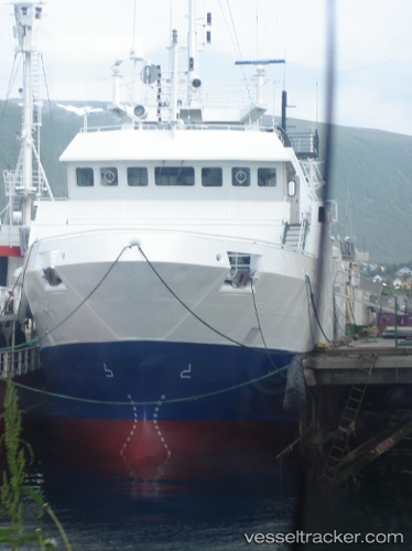
 Viking Alliance
Current Status
Where is the vessel?
Viking Alliance is currently in Near PORT ALBERNI, based on AIS data received less than 1h ago.
Latest AIS update:
Current position: 49.22583° N, 124.81413° W (Near PORT ALBERNI)
Average speed (last 7 days): Loading…
Average speed (last 30 days): Loading…
Vessel profile: Viking Alliance is a Fishing Vessel with dimensions 41m x 41m.
This page combines live AIS, route history, probable destination signals, nearby traffic, and port activity for practical vessel monitoring.
The current position of vessel Viking Alliance is 49.22583 lat / -124.81413 lng. Updated: 2026-04-07 08:08:14 UTCNearest reference points:
- 21 nm NW of Tatoosh Island
- Near Powell River
- Near Nanaimo
Currently sailing under the flag of Canada ![]()
Viking Alliance built in 1996 year
Deadweight:
401 tDetails:
Live Vessel Viking Alliance Analytics (details, animations, etc.)
Recent AIS points (UTC):
2026-04-07 01:34:45 UTC · 49.22500, -124.81333 · SOG 0 kn · COG -1°2026-04-07 03:23:15 UTC · 49.22583, -124.81419 · SOG 0 kn · COG -1°
2026-04-07 05:50:11 UTC · 49.22585, -124.81418 · SOG 0 kn · COG -1°
2026-04-07 08:08:14 UTC · 49.22583, -124.81413 · SOG 0 kn · COG -1°