 vesseltracker.com
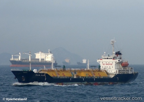
Runfar
Current StatusWhere is the vessel?
Runfar is currently in 82 nm N of Cide, based on AIS data received about 3d ago.
Latest AIS update:
Current position: 43.20167° N, 32.41167° E (82 nm N of Cide)
Average speed (last 7 days): Loading…
Average speed (last 30 days): Loading…
Vessel profile: Runfar is a Lpg Tanker with dimensions 17m x 105m.
This page combines live AIS, route history, probable destination signals, nearby traffic, and port activity for practical vessel monitoring.
The current position of vessel Runfar is 43.20167 lat / 32.41167 lng. Updated: 2026-03-30 16:22:51 UTCNearest reference points:
- 27 nm NW of INEBOLU
- Near Cide
- 18 nm NW of INEBOLU
Details:
Live Vessel Runfar Analytics (details, animations, etc.)
Recent AIS points (UTC):
2026-03-30 07:29:58 UTC · 42.84481, 30.04474 · SOG 12.6 kn · COG 70°2026-03-30 16:22:51 UTC · 43.20167, 32.41167 · SOG 12 kn · COG -1°
2026-03-30 16:22:51 UTC · 43.20167, 32.41167 · SOG 12 kn · COG -1°
2026-03-30 16:22:51 UTC · 43.20167, 32.41167 · SOG 12 kn · COG -1°