 vesseltracker.com
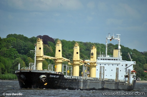
 MOHAMAD M
Current Status
Where is the vessel?
MOHAMAD M is currently in Near Al Marsá, based on AIS data received less than 1h ago.
Latest AIS update:
Current position: 36.83276° N, 10.50418° E (Near Al Marsá)
Average speed (last 7 days): Loading…
Average speed (last 30 days): Loading…
Vessel profile: MOHAMAD M is a Bulk Carrier with dimensions m x m.
This page combines live AIS, route history, probable destination signals, nearby traffic, and port activity for practical vessel monitoring.
The current position of vessel MOHAMAD M is 36.83276 lat / 10.50418 lng. Updated: 2026-03-30 05:19:24 UTCNearest reference points:
- Near Le Kram
- 13 nm N of Qulaybiyah
- 32 nm N of Qulaybiyah
Currently sailing under the flag of San Marino ![]()
Details:
Live Vessel MOHAMAD M Analytics (details, animations, etc.)
Recent AIS points (UTC):
2026-03-29 23:42:26 UTC · 36.83197, 10.50367 · SOG 0 kn · COG 306°2026-03-30 01:38:58 UTC · 36.83249, 10.50404 · SOG 0 kn · COG -1°
2026-03-30 03:40:43 UTC · 36.83167, 10.50333 · SOG 0 kn · COG -1°
2026-03-30 05:19:24 UTC · 36.83276, 10.50418 · SOG 0 kn · COG -1°