 vesseltracker.com
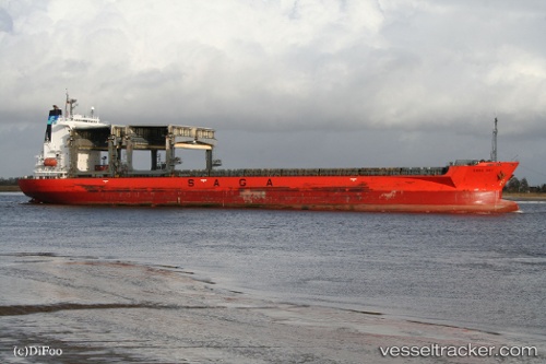
 SAGA SKY
Current Status
Where is the vessel?
SAGA SKY is currently in Near BOTLEK - ROTTERDAM, based on AIS data received less than 1h ago.
Latest AIS update:
Current position: 51.88643° N, 4.29899° E (Near BOTLEK - ROTTERDAM)
Average speed (last 7 days): Loading…
Average speed (last 30 days): Loading…
Vessel profile: SAGA SKY is a General Cargo with dimensions m x m.
This page combines live AIS, route history, probable destination signals, nearby traffic, and port activity for practical vessel monitoring.
The current position of vessel SAGA SKY is 51.88643 lat / 4.29899 lng. Updated: 2026-04-02 03:44:41 UTCNearest reference points:
- Near BOTLEK - ROTTERDAM
- Near Vlaardingen
- Near VLAARDINGEN - ROTTERDAM
Currently sailing under the flag of Bahamas ![]()
Details:
Live Vessel SAGA SKY Analytics (details, animations, etc.)
Recent AIS points (UTC):
2026-04-01 22:06:14 UTC · 51.88643, 4.29899 · SOG 0 kn · COG 252°2026-04-02 00:08:42 UTC · 51.88641, 4.29897 · SOG 0 kn · COG 252°
2026-04-02 02:08:48 UTC · 51.88644, 4.29898 · SOG 0 kn · COG 252°
2026-04-02 03:44:41 UTC · 51.88643, 4.29899 · SOG 0 kn · COG 251°