 vesseltracker.com
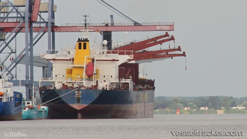
 LAMAR S
Current Status
Where is the vessel?
LAMAR S is currently in Near Choueifat, based on AIS data received about 1d ago.
Latest AIS update:
Current position: 33.81867° N, 35.49623° E (Near Choueifat)
Average speed (last 7 days): Loading…
Average speed (last 30 days): Loading…
Vessel profile: LAMAR S is a Bulk Carrier with dimensions m x m.
This page combines live AIS, route history, probable destination signals, nearby traffic, and port activity for practical vessel monitoring.
The current position of vessel LAMAR S is 33.81867 lat / 35.49623 lng. Updated: 2026-04-10 06:51:30 UTCNearest reference points:
- Near DBAIYEH
- Near Zouk
- Near Tripoli
Currently sailing under the flag of Saint Kitts and Nevis ![]()
Details:
Live Vessel LAMAR S Analytics (details, animations, etc.)
Recent AIS points (UTC):
2026-04-10 02:16:25 UTC · 33.81864, 35.49637 · SOG 0 kn · COG 198°2026-04-10 03:40:41 UTC · 33.81833, 35.49500 · SOG 0 kn · COG -1°
2026-04-10 03:40:41 UTC · 33.81833, 35.49500 · SOG 0 kn · COG -1°
2026-04-10 06:51:30 UTC · 33.81867, 35.49623 · SOG 0 kn · COG 206°