 vesseltracker.com
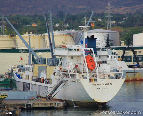
 SIERRA LAUREL
Current Status
Where is the vessel?
SIERRA LAUREL is currently in Near SCHEVENINGEN, based on AIS data received less than 1h ago.
Latest AIS update:
Current position: 52.18147° N, 4.22415° E (Near SCHEVENINGEN)
Average speed (last 7 days): Loading…
Average speed (last 30 days): Loading…
Vessel profile: SIERRA LAUREL is a Reefer with dimensions m x m.
This page combines live AIS, route history, probable destination signals, nearby traffic, and port activity for practical vessel monitoring.
The current position of vessel SIERRA LAUREL is 52.18147 lat / 4.22415 lng. Updated: 2026-04-18 14:02:38 UTCNearest reference points:
- Near SCHEVENINGEN
- Near HOEK VAN HOLLAND
- Near MAASVLAKTE - ROTTERDAM
Currently sailing under the flag of Bahamas ![]()
Details:
Live Vessel SIERRA LAUREL Analytics (details, animations, etc.)
Recent AIS points (UTC):
2026-04-18 07:55:10 UTC · 51.91138, 4.41643 · SOG 0 kn · COG 211°2026-04-18 09:47:08 UTC · 51.91143, 4.41651 · SOG 0 kn · COG 211°
2026-04-18 12:20:47 UTC · 52.03212, 3.90173 · SOG 7.3 kn · COG 313°
2026-04-18 14:02:38 UTC · 52.18147, 4.22415 · SOG 0 kn · COG 213°