 vesseltracker.com
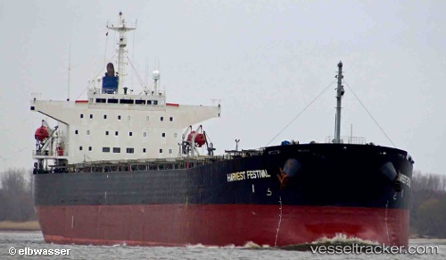
 HARBOUR WELL
Current Status
Where is the vessel?
HARBOUR WELL is currently in 119 nm NW of Bangui, based on AIS data received about 1h ago.
Latest AIS update:
Current position: 20.25167° N, 119.71667° E (119 nm NW of Bangui)
Average speed (last 7 days): Loading…
Average speed (last 30 days): Loading…
Vessel profile: HARBOUR WELL is a Bulk Carrier with dimensions 32m x 224m.
This page combines live AIS, route history, probable destination signals, nearby traffic, and port activity for practical vessel monitoring.
The current position of vessel HARBOUR WELL is 20.25167 lat / 119.71667 lng. Updated: 2026-04-07 12:21:25 UTCNearest reference points:
- 132 nm SW of Kaohsiung
- 106 nm W of Basco
- 101 nm S of Kaohsiung
Currently sailing under the flag of Panama ![]()
HARBOUR WELL built in 1998 year
Deadweight:
72497 tDetails:
Live Vessel HARBOUR WELL Analytics (details, animations, etc.)
Recent AIS points (UTC):
2026-04-07 05:37:01 UTC · 18.88500, 119.64667 · SOG 12 kn · COG -1°2026-04-07 07:13:32 UTC · 19.20833, 119.65667 · SOG 12 kn · COG -1°
2026-04-07 09:50:29 UTC · 19.72667, 119.68500 · SOG 12 kn · COG -1°
2026-04-07 12:21:25 UTC · 20.25167, 119.71667 · SOG 12 kn · COG -1°