 vesseltracker.com
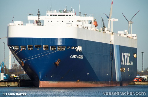
 LIBRA LEADER
Current Status
Where is the vessel?
LIBRA LEADER is currently in Near Mihama, based on AIS data received about 1h ago.
Latest AIS update:
Current position: 34.72559° N, 136.83073° E (Near Mihama)
Average speed (last 7 days): Loading…
Average speed (last 30 days): Loading…
Vessel profile: LIBRA LEADER is a Vehicles Carrier with dimensions m x m.
This page combines live AIS, route history, probable destination signals, nearby traffic, and port activity for practical vessel monitoring.
The current position of vessel LIBRA LEADER is 34.72559 lat / 136.83073 lng. Updated: 2026-03-30 11:35:50 UTCNearest reference points:
- Near Mihama
- Near Kinuura
- Near Atumi
Currently sailing under the flag of Liberia ![]()
Details:
Live Vessel LIBRA LEADER Analytics (details, animations, etc.)
Recent AIS points (UTC):
2026-03-30 05:28:59 UTC · 34.72410, 137.30110 · SOG 0 kn · COG 179°2026-03-30 07:25:59 UTC · 34.72414, 137.30106 · SOG 0 kn · COG 179°
2026-03-30 09:52:37 UTC · 34.73275, 137.29988 · SOG 5.6 kn · COG 285°
2026-03-30 11:35:50 UTC · 34.72559, 136.83073 · SOG 18.2 kn · COG 310°