 vesseltracker.com
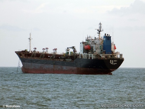
 SEA GULL 9
Current Status
Where is the vessel?
SEA GULL 9 is currently in 17 nm SW of Banting, based on AIS data received less than 1h ago.
Latest AIS update:
Current position: 2.65415° N, 101.25895° E (17 nm SW of Banting)
Average speed (last 7 days): Loading…
Average speed (last 30 days): Loading…
Vessel profile: SEA GULL 9 is a Chemical Tanker with dimensions 18m x 128m.
This page combines live AIS, route history, probable destination signals, nearby traffic, and port activity for practical vessel monitoring.
The current position of vessel SEA GULL 9 is 2.65415 lat / 101.25895 lng. Updated: 2026-03-29 12:17:17 UTCNearest reference points:
- 15 nm SW of Banting
- 14 nm SW of Banting
- Near Pulau Indah
Currently sailing under the flag of Belize ![]()
SEA GULL 9 built in 1998 year
Deadweight:
11131 tDetails:
Live Vessel SEA GULL 9 Analytics (details, animations, etc.)
Recent AIS points (UTC):
2026-03-29 05:45:38 UTC · 3.42171, 100.19003 · SOG 12.8 kn · COG 130°2026-03-29 07:37:52 UTC · 3.16542, 100.48738 · SOG 12.1 kn · COG -1°
2026-03-29 09:35:02 UTC · 2.92506, 100.79873 · SOG 11.8 kn · COG -1°
2026-03-29 12:17:17 UTC · 2.65415, 101.25895 · SOG 11.8 kn · COG -1°