 vesseltracker.com
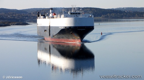
 Chang Rong Kou
Current Status
Where is the vessel?
Chang Rong Kou is currently in 303 nm E of Suqutrá, based on AIS data received about 1d ago.
Latest AIS update:
Current position: 12.94167° N, 59.15833° E (303 nm E of Suqutrá)
Average speed (last 7 days): Loading…
Average speed (last 30 days): Loading…
Vessel profile: Chang Rong Kou is a Vehicles Carrier with dimensions 177m x 31m.
This page combines live AIS, route history, probable destination signals, nearby traffic, and port activity for practical vessel monitoring.
The current position of vessel Chang Rong Kou is 12.94167 lat / 59.15833 lng. Updated: 2026-04-10 06:36:15 UTCNearest reference points:
- Open sea, approx. 412 nm off the nearest listed port
- Open sea, approx. 420 nm off the nearest listed port
- Open sea, approx. 410 nm off the nearest listed port
Currently sailing under the flag of China ![]()
Chang Rong Kou built in 2000 year
Deadweight:
12778 tDetails:
Live Vessel Chang Rong Kou Analytics (details, animations, etc.)
Recent AIS points (UTC):
2026-04-10 01:33:30 UTC · 12.54517, 60.46124 · SOG 15.7 kn · COG 290°2026-04-10 03:42:15 UTC · 12.71333, 59.91167 · SOG 15 kn · COG -1°
2026-04-10 05:57:12 UTC · 12.88833, 59.32667 · SOG 15 kn · COG -1°
2026-04-10 06:36:15 UTC · 12.94167, 59.15833 · SOG 15 kn · COG -1°