 vesseltracker.com
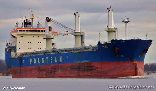
 OLIVIA
Current Status
Where is the vessel?
OLIVIA is currently in 16 nm SW of Areópolis, based on AIS data received about 1h ago.
Latest AIS update:
Current position: 36.46114° N, 22.15986° E (16 nm SW of Areópolis)
Average speed (last 7 days): Loading…
Average speed (last 30 days): Loading…
Vessel profile: OLIVIA is a Bulk Carrier with dimensions m x m.
This page combines live AIS, route history, probable destination signals, nearby traffic, and port activity for practical vessel monitoring.
The current position of vessel OLIVIA is 36.46114 lat / 22.15986 lng. Updated: 2026-03-29 01:06:48 UTCNearest reference points:
- 17 nm S of Areópolis
- 23 nm S of Methoni
- Near Kythira
Currently sailing under the flag of Antigua and Barbuda ![]()
Details:
Live Vessel OLIVIA Analytics (details, animations, etc.)
Recent AIS points (UTC):
2026-03-28 19:38:38 UTC · 37.35355, 21.28717 · SOG 13.2 kn · COG 160°2026-03-28 21:46:37 UTC · 36.90956, 21.51313 · SOG 13.2 kn · COG 159°
2026-03-28 23:23:38 UTC · 36.61020, 21.72681 · SOG 13.1 kn · COG 111°
2026-03-29 01:06:48 UTC · 36.46114, 22.15986 · SOG 13.2 kn · COG 111°