 vesseltracker.com
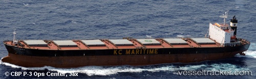
 Rya Rad
Current Status
Where is the vessel?
Rya Rad is currently in 55 nm SW of Al Hudaydah, based on AIS data received less than 1h ago.
Latest AIS update:
Current position: 14.19333° N, 42.20667° E (55 nm SW of Al Hudaydah)
Average speed (last 7 days): Loading…
Average speed (last 30 days): Loading…
Vessel profile: Rya Rad is a Bulk Carrier with dimensions 225m x 225m.
This page combines live AIS, route history, probable destination signals, nearby traffic, and port activity for practical vessel monitoring.
The current position of vessel Rya Rad is 14.19333 lat / 42.20667 lng. Updated: 2026-04-09 23:37:01 UTCNearest reference points:
- 81 nm NW of As Salif
Currently sailing under the flag of Panama ![]()
Rya Rad built in 1999 year
Deadweight:
73705 tDetails:
Live Vessel Rya Rad Analytics (details, animations, etc.)
Recent AIS points (UTC):
2026-04-09 17:42:57 UTC · 15.11667, 41.70833 · SOG 10 kn · COG -1°2026-04-09 19:48:58 UTC · 14.79167, 41.88500 · SOG 10 kn · COG -1°
2026-04-09 22:07:00 UTC · 14.43167, 42.07667 · SOG 10 kn · COG -1°
2026-04-09 23:37:01 UTC · 14.19333, 42.20667 · SOG 10 kn · COG -1°