 vesseltracker.com
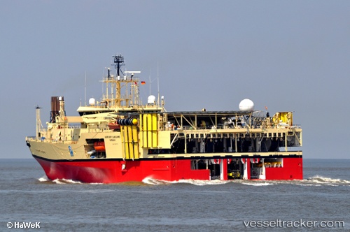
 RAMFORM VANGUARD
Current Status
Where is the vessel?
RAMFORM VANGUARD is currently in 43 nm NW of Leba, based on AIS data received about 2h ago.
Latest AIS update:
Current position: 55.37833° N, 16.96500° E (43 nm NW of Leba)
Average speed (last 7 days): Loading…
Average speed (last 30 days): Loading…
Vessel profile: RAMFORM VANGUARD is a Research/Survey Vessel with dimensions m x m.
This page combines live AIS, route history, probable destination signals, nearby traffic, and port activity for practical vessel monitoring.
The current position of vessel RAMFORM VANGUARD is 55.37833 lat / 16.96500 lng. Updated: 2026-04-06 01:27:01 UTCNearest reference points:
- 31 nm NW of Ustka
- Near WLADYSLAWOWO
- Near Karlskrona
Currently sailing under the flag of Bahamas ![]()
Details:
Live Vessel RAMFORM VANGUARD Analytics (details, animations, etc.)
Recent AIS points (UTC):
2026-04-05 15:48:02 UTC · 55.44667, 17.05500 · SOG 9 kn · COG -1°2026-04-05 20:06:02 UTC · 55.42833, 17.11500 · SOG 4 kn · COG -1°
2026-04-05 23:45:08 UTC · 55.34333, 16.69167 · SOG 4 kn · COG -1°
2026-04-06 01:27:01 UTC · 55.37833, 16.96500 · SOG 6 kn · COG -1°