 vesseltracker.com
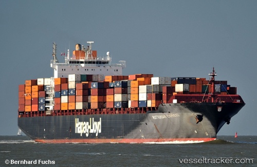
 AMSTERDAM EXPRESS
Current Status
Where is the vessel?
AMSTERDAM EXPRESS is currently in 21 nm E of Neapolis, based on AIS data received about 1h ago.
Latest AIS update:
Current position: 36.58664° N, 23.48166° E (21 nm E of Neapolis)
Average speed (last 7 days): Loading…
Average speed (last 30 days): Loading…
Vessel profile: AMSTERDAM EXPRESS is a Container Ship with dimensions m x m.
This page combines live AIS, route history, probable destination signals, nearby traffic, and port activity for practical vessel monitoring.
The current position of vessel AMSTERDAM EXPRESS is 36.58664 lat / 23.48166 lng. Updated: 2026-04-21 09:22:44 UTCNearest reference points:
- 20 nm E of FOKIANOS
- 17 nm W of Milos (Adamas)
- Near Kythira
Currently sailing under the flag of Liberia ![]()
Details:
Live Vessel AMSTERDAM EXPRESS Analytics (details, animations, etc.)
Recent AIS points (UTC):
2026-04-21 05:58:51 UTC · 37.24653, 24.06867 · SOG 14.5 kn · COG 201°2026-04-21 07:36:33 UTC · 36.92316, 23.79662 · SOG 14.2 kn · COG 212°
2026-04-21 08:09:02 UTC · 36.81700, 23.70713 · SOG 14.4 kn · COG 220°
2026-04-21 09:22:44 UTC · 36.58664, 23.48166 · SOG 14.1 kn · COG 221°