 vesseltracker.com
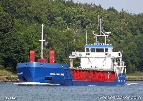
 Thea Marieke
Current Status
Where is the vessel?
Thea Marieke is currently in 19 nm W of Saint David's, based on AIS data received about 2h ago.
Latest AIS update:
Current position: 51.96729° N, 5.76594° W (19 nm W of Saint David's)
Average speed (last 7 days): Loading…
Average speed (last 30 days): Loading…
Vessel profile: Thea Marieke is a General Cargo Ship with dimensions 83m x 13m.
This page combines live AIS, route history, probable destination signals, nearby traffic, and port activity for practical vessel monitoring.
The current position of vessel Thea Marieke is 51.96729 lat / -5.76594 lng. Updated: 2026-03-29 19:28:34 UTCNearest reference points:
- Near WEXFORD
- Near ARKLOW
- Near WICKLOW
Currently sailing under the flag of Netherlands ![]()
Thea Marieke built in 2001 year
Deadweight:
3149 tDetails:
Live Vessel Thea Marieke Analytics (details, animations, etc.)
Recent AIS points (UTC):
2026-03-29 14:18:15 UTC · 51.10171, -5.86061 · SOG 9.5 kn · COG 348°2026-03-29 15:37:43 UTC · 51.31221, -5.87549 · SOG 9.5 kn · COG 353°
2026-03-29 17:19:40 UTC · 51.59194, -5.87441 · SOG 9.6 kn · COG -1°
2026-03-29 19:28:34 UTC · 51.96729, -5.76594 · SOG 10.8 kn · COG 3°