 vesseltracker.com
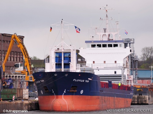
Find the position of the vessel Fluvius Taw on the map. The latter are known coordinates and path.
marine traffic ship tracker show on live map
The current position of vessel Fluvius Taw is 36.7395 lat / -9.48943 lng. Updated: 2024-05-04 08:27:26 UTCCurrently sailing under the flag of Barbados
Fluvius Taw built in 2000 year
Port of registry:
Bridgetown (capital of Barbados)Speed:
11.5 knotDeadweight:
5050 tGross tonnage:
2998Service entry:
2000-01-01T00:00:00ZManufacturer:
Galați shipyard (Shipyard in Romania)
Details:
Last coordinates of the vessel:
UTC, 37.3604, -9.74371, course: 165, speed: 10UTC, 37.2234, -9.69834, course: 165, speed: 10.3
UTC, 36.9027, -9.58729, course: 167, speed: 10.3
2024-05-04 08:27:26 UTC, 36.7395, -9.48943, course: 140, speed: 10.2