 vesseltracker.com
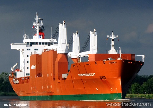
 Schippersgracht
Current Status
Where is the vessel?
Schippersgracht is currently in 53 nm NE of Strå, based on AIS data received less than 1h ago.
Latest AIS update:
Current position: 58.56215° N, 20.06678° E (53 nm NE of Strå)
Average speed (last 7 days): Loading…
Average speed (last 30 days): Loading…
Vessel profile: Schippersgracht is a General Cargo Ship with dimensions 168m x 24m.
This page combines live AIS, route history, probable destination signals, nearby traffic, and port activity for practical vessel monitoring.
The current position of vessel Schippersgracht is 58.56215 lat / 20.06678 lng. Updated: 2026-03-30 07:50:00 UTCNearest reference points:
- 37 nm W of Vikati Sadam
- Near NOTTNAS
- 20 nm W of Kalana
Currently sailing under the flag of Netherlands ![]()
Schippersgracht built in 2000 year
Deadweight:
21402 tDetails:
Live Vessel Schippersgracht Analytics (details, animations, etc.)
Recent AIS points (UTC):
2026-03-30 01:43:21 UTC · 59.95209, 19.38571 · SOG 14.8 kn · COG 144°2026-03-30 03:40:51 UTC · 59.59038, 20.01616 · SOG 14.6 kn · COG 137°
2026-03-30 06:25:46 UTC · 58.92819, 20.06831 · SOG 15.6 kn · COG 182°
2026-03-30 07:50:00 UTC · 58.56215, 20.06678 · SOG 15.5 kn · COG 182°