 vesseltracker.com
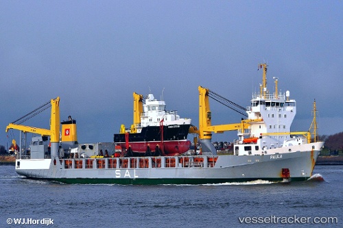
 Paula
Paula
Current Status
Where is the vessel?
Paula is currently in 236 nm E of Tan Cang Qui Nhon, based on AIS data received about 1h ago.
Latest AIS update:
Current position: 13.73184° N, 113.87207° E (236 nm E of Tan Cang Qui Nhon)
Average speed (last 7 days): Loading…
Average speed (last 30 days): Loading…
Vessel profile: Paula is a Heavy Load Carrier with dimensions 151m x 20m.
This page combines live AIS, route history, probable destination signals, nearby traffic, and port activity for practical vessel monitoring.
The current position of vessel Paula is 13.73184 lat / 113.87207 lng. Updated: 2026-03-29 20:00:59 UTCNearest reference points:
- 232 nm E of Tan Cang Qui Nhon
- 222 nm E of Tan Cang Qui Nhon
- 282 nm E of Tan Cang Qui Nhon
Currently sailing under the flag of Antigua Barbuda ![]()
Paula built in 2000 year
Deadweight:
9361 tDetails:
Live Vessel Paula Analytics (details, animations, etc.)
Recent AIS points (UTC):
2026-03-29 13:21:59 UTC · 12.16817, 112.56915 · SOG 18 kn · COG 39°2026-03-29 15:15:29 UTC · 12.61665, 112.93331 · SOG 18 kn · COG 41°
2026-03-29 15:45:05 UTC · 12.73252, 113.03045 · SOG 18.2 kn · COG 41°
2026-03-29 20:00:59 UTC · 13.73184, 113.87207 · SOG 18.1 kn · COG 40°