 vesseltracker.com
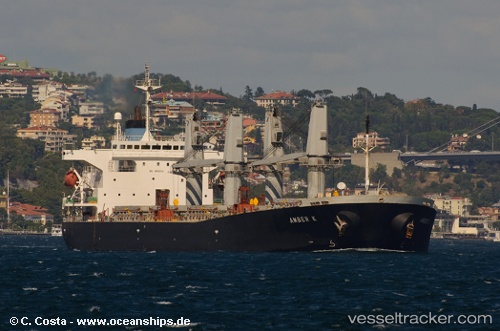
 Amber S
Current Status
Where is the vessel?
Amber S is currently in Near Iskenderun, based on AIS data received about 2h ago.
Latest AIS update:
Current position: 36.59597° N, 36.07113° E (Near Iskenderun)
Average speed (last 7 days): Loading…
Average speed (last 30 days): Loading…
Vessel profile: Amber S is a Crude Oil Tanker with dimensions 185m x 30m.
This page combines live AIS, route history, probable destination signals, nearby traffic, and port activity for practical vessel monitoring.
The current position of vessel Amber S is 36.59597 lat / 36.07113 lng. Updated: 2026-03-27 20:21:43 UTCNearest reference points:
- Near Iskenderun
- 13 nm W of Iskenderun
- Near DORTYOL
Currently sailing under the flag of Liberia ![]()
Amber S built in 2000 year
Deadweight:
47282 tDetails:
Live Vessel Amber S Analytics (details, animations, etc.)
Recent AIS points (UTC):
2026-03-27 13:54:44 UTC · 36.59585, 36.07122 · SOG 0.1 kn · COG 250°2026-03-27 15:54:44 UTC · 36.59586, 36.07122 · SOG 0.2 kn · COG 248°
2026-03-27 18:09:41 UTC · 36.59608, 36.07100 · SOG 0.2 kn · COG 237°
2026-03-27 20:21:43 UTC · 36.59597, 36.07113 · SOG 0.1 kn · COG 243°