 vesseltracker.com
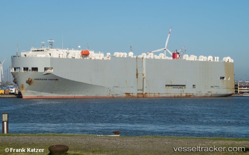
American Highway
Current StatusWhere is the vessel?
American Highway is currently in 276 nm W of Panjang, based on AIS data received about 1h ago.
Latest AIS update:
Current position: 7.80717° S, 100.88477° E (276 nm W of Panjang)
Average speed (last 7 days): Loading…
Average speed (last 30 days): Loading…
Vessel profile: American Highway is a Vehicles Carrier with dimensions 32m x 180m.
This page combines live AIS, route history, probable destination signals, nearby traffic, and port activity for practical vessel monitoring.
The current position of vessel American Highway is -7.80717 lat / 100.88477 lng. Updated: 2026-03-30 01:22:57 UTCNearest reference points:
- 293 nm SW of Lahat
- 163 nm W of Panjang
Details:
Live Vessel American Highway Analytics (details, animations, etc.)
Recent AIS points (UTC):
2026-03-29 20:11:12 UTC · -7.34927, 102.23784 · SOG 16.3 kn · COG 250°2026-03-29 21:49:34 UTC · -7.49748, 101.80828 · SOG 16.5 kn · COG 252°
2026-03-30 00:03:43 UTC · -7.69064, 101.22579 · SOG 16.6 kn · COG 255°
2026-03-30 01:22:57 UTC · -7.80717, 100.88477 · SOG 16.3 kn · COG 252°