 vesseltracker.com
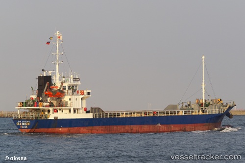
 Sea Bridge
Current Status
Where is the vessel?
Sea Bridge is currently in 17 nm N of Yantai Pt, based on AIS data received about 1h ago.
Latest AIS update:
Current position: 37.82793° N, 121.51833° E (17 nm N of Yantai Pt)
Average speed (last 7 days): Loading…
Average speed (last 30 days): Loading…
Vessel profile: Sea Bridge is a General Cargo Ship with dimensions 76m x 76m.
This page combines live AIS, route history, probable destination signals, nearby traffic, and port activity for practical vessel monitoring.
The current position of vessel Sea Bridge is 37.82793 lat / 121.51833 lng. Updated: 2026-03-27 05:49:40 UTCNearest reference points:
- 18 nm N of Yantai Pt
- Near Yantai
- Near Yantai Pt
Currently sailing under the flag of Belize ![]()
Sea Bridge built in 1998 year
Deadweight:
1593 tDetails:
Live Vessel Sea Bridge Analytics (details, animations, etc.)
Recent AIS points (UTC):
2026-03-27 00:19:30 UTC · 38.15070, 120.24023 · SOG 10.5 kn · COG 123°2026-03-27 02:37:10 UTC · 37.99986, 120.76056 · SOG 12.8 kn · COG 98°
2026-03-27 03:56:50 UTC · 37.93055, 121.09222 · SOG 11.7 kn · COG 106°
2026-03-27 05:49:40 UTC · 37.82793, 121.51833 · SOG 10.9 kn · COG 103°