 vesseltracker.com
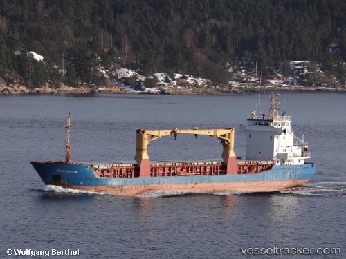
 SANTA BARBARA
Current Status
Where is the vessel?
SANTA BARBARA is currently in Near Mariel, based on AIS data received about 2h ago.
Latest AIS update:
Current position: 22.99551° N, 82.75402° W (Near Mariel)
Average speed (last 7 days): Loading…
Average speed (last 30 days): Loading…
Vessel profile: SANTA BARBARA is a General Cargo with dimensions m x m.
This page combines live AIS, route history, probable destination signals, nearby traffic, and port activity for practical vessel monitoring.
The current position of vessel SANTA BARBARA is 22.99551 lat / -82.75402 lng. Updated: 2026-03-31 01:57:35 UTCNearest reference points:
- Near Mariel
- Near ALAMEDA DEL SIBONEY
- 40 nm S of Florida Straits
Currently sailing under the flag of Barbados ![]()
Details:
Live Vessel SANTA BARBARA Analytics (details, animations, etc.)
Recent AIS points (UTC):
2026-03-30 19:28:25 UTC · 22.99552, -82.75404 · SOG 0 kn · COG 343°2026-03-30 19:28:25 UTC · 22.99552, -82.75404 · SOG 0 kn · COG 343°
2026-03-31 01:13:11 UTC · 22.99551, -82.75402 · SOG 0 kn · COG 342°
2026-03-31 01:57:35 UTC · 22.99551, -82.75402 · SOG 0 kn · COG 342°