 vesseltracker.com
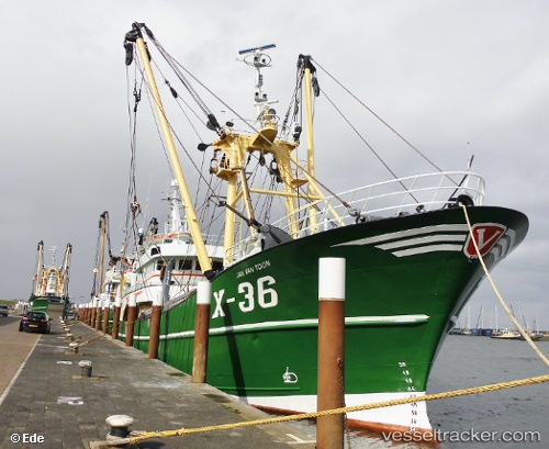
 JAN VAN TOON
Current Status
Where is the vessel?
JAN VAN TOON is currently in Near OUDESCHILD, based on AIS data received about 1h ago.
Latest AIS update:
Current position: 53.04176° N, 4.85244° E (Near OUDESCHILD)
Average speed (last 7 days): Loading…
Average speed (last 30 days): Loading…
Vessel profile: JAN VAN TOON is a Fishing Vessel with dimensions m x m.
This page combines live AIS, route history, probable destination signals, nearby traffic, and port activity for practical vessel monitoring.
The current position of vessel JAN VAN TOON is 53.04176 lat / 4.85244 lng. Updated: 2026-04-18 09:49:29 UTCNearest reference points:
- Near OUDESCHILD
- Near TEXEL
- Near de Waal
Currently sailing under the flag of Netherlands ![]()
JAN VAN TOON built in 2000 year
Deadweight:
365 tDetails:
Live Vessel JAN VAN TOON Analytics (details, animations, etc.)
Recent AIS points (UTC):
2026-04-18 04:19:28 UTC · 53.04175, 4.85250 · SOG 0 kn · COG 20°2026-04-18 06:17:00 UTC · 53.04172, 4.85246 · SOG 0 kn · COG 21°
2026-04-18 07:57:59 UTC · 53.04182, 4.85248 · SOG 0 kn · COG 20°
2026-04-18 09:49:29 UTC · 53.04176, 4.85244 · SOG 0 kn · COG 21°