 vesseltracker.com
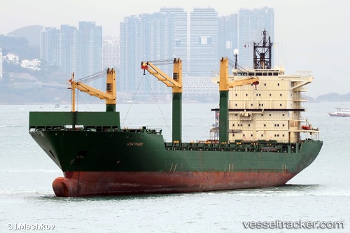
 MERATUS JAYAGIRI
Current Status
Where is the vessel?
MERATUS JAYAGIRI is currently in 18 nm E of Ben Dam Con Dao Terminals, based on AIS data received about 2h ago.
Latest AIS update:
Current position: 8.53542° N, 106.83513° E (18 nm E of Ben Dam Con Dao Terminals)
Average speed (last 7 days): Loading…
Average speed (last 30 days): Loading…
Vessel profile: MERATUS JAYAGIRI is a Container Ship with dimensions m x m.
This page combines live AIS, route history, probable destination signals, nearby traffic, and port activity for practical vessel monitoring.
The current position of vessel MERATUS JAYAGIRI is 8.53542 lat / 106.83513 lng. Updated: 2026-04-22 16:43:33 UTCNearest reference points:
- 59 nm SW of Bach Ho
- 50 nm SW of Ben Dam Con Dao Terminals
- 21 nm E of Cai Cui Port
Currently sailing under the flag of Panama ![]()
Details:
Live Vessel MERATUS JAYAGIRI Analytics (details, animations, etc.)
Recent AIS points (UTC):
2026-04-22 13:29:59 UTC · 8.60904, 106.96296 · SOG 15.3 kn · COG 203°2026-04-22 13:29:59 UTC · 8.60904, 106.96296 · SOG 15.3 kn · COG 203°
2026-04-22 16:43:33 UTC · 8.53542, 106.83513 · SOG 15.8 kn · COG 240°
2026-04-22 16:43:33 UTC · 8.53542, 106.83513 · SOG 15.8 kn · COG 240°