 vesseltracker.com
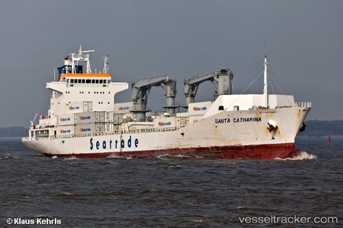
 SANTA CATHARINA
Current Status
Where is the vessel?
SANTA CATHARINA is currently in Near TONOSHO, based on AIS data received less than 1h ago.
Latest AIS update:
Current position: 34.40500° N, 134.27222° E (Near TONOSHO)
Average speed (last 7 days): Loading…
Average speed (last 30 days): Loading…
Vessel profile: SANTA CATHARINA is a Reefer with dimensions m x m.
This page combines live AIS, route history, probable destination signals, nearby traffic, and port activity for practical vessel monitoring.
The current position of vessel SANTA CATHARINA is 34.40500 lat / 134.27222 lng. Updated: 2026-04-15 23:21:59 UTCNearest reference points:
- Near TONOSHO
- Near AJICHO
- Near TAKAMATSU
Currently sailing under the flag of Liberia ![]()
Details:
Live Vessel SANTA CATHARINA Analytics (details, animations, etc.)
Recent AIS points (UTC):
2026-04-15 18:02:44 UTC · 34.66786, 135.22273 · SOG 0 kn · COG -1°2026-04-15 20:22:45 UTC · 34.64567, 135.26744 · SOG 13.4 kn · COG 164°
2026-04-15 22:06:49 UTC · 34.52561, 134.70651 · SOG 18.8 kn · COG 246°
2026-04-15 23:21:59 UTC · 34.40500, 134.27222 · SOG 17 kn · COG 272°