 vesseltracker.com
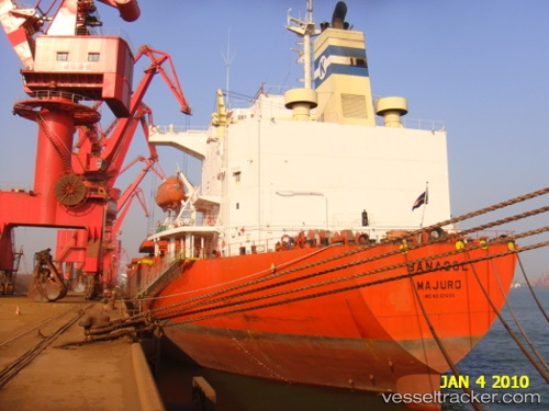
 Banasol
Current Status
Where is the vessel?
Banasol is currently in 34 nm NE of Ulleung-gun, based on AIS data received less than 1h ago.
Latest AIS update:
Current position: 37.88317° N, 131.40060° E (34 nm NE of Ulleung-gun)
Average speed (last 7 days): Loading…
Average speed (last 30 days): Loading…
Vessel profile: Banasol is a Bulk Oil Carrier with dimensions 225m x 225m.
This page combines live AIS, route history, probable destination signals, nearby traffic, and port activity for practical vessel monitoring.
The current position of vessel Banasol is 37.88317 lat / 131.40060 lng. Updated: 2026-04-07 08:07:37 UTCNearest reference points:
- 33 nm NE of Ulleung-gun
- 94 nm N of Dokdo
- 96 nm N of Ulleung-gun
Currently sailing under the flag of Marshall Is ![]()
Banasol built in 2001 year
Deadweight:
72562 tDetails:
Live Vessel Banasol Analytics (details, animations, etc.)
Recent AIS points (UTC):
2026-04-06 18:32:50 UTC · 40.24226, 132.25797 · SOG 11.5 kn · COG 177°2026-04-06 18:32:50 UTC · 40.24226, 132.25797 · SOG 11.5 kn · COG 177°
2026-04-07 06:13:57 UTC · 38.22641, 131.51283 · SOG 11.5 kn · COG 192°
2026-04-07 08:07:37 UTC · 37.88317, 131.40060 · SOG 10.8 kn · COG 198°