 vesseltracker.com
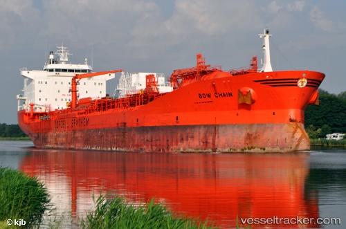
 BOW CHAIN
Current Status
Where is the vessel?
BOW CHAIN is currently in Near Belle Chase, based on AIS data received less than 1h ago.
Latest AIS update:
Current position: 29.83940° N, 89.99224° W (Near Belle Chase)
Average speed (last 7 days): Loading…
Average speed (last 30 days): Loading…
Vessel profile: BOW CHAIN is a Oil/Chemical Tanker with dimensions m x m.
This page combines live AIS, route history, probable destination signals, nearby traffic, and port activity for practical vessel monitoring.
The current position of vessel BOW CHAIN is 29.83940 lat / -89.99224 lng. Updated: 2026-04-16 22:00:36 UTCNearest reference points:
- Near Meraux
- Near Marrero
- Near Pointe a la Hache
Currently sailing under the flag of Marshall Islands ![]()
Details:
Live Vessel BOW CHAIN Analytics (details, animations, etc.)
Recent AIS points (UTC):
2026-04-16 14:24:36 UTC · 29.83919, -89.99204 · SOG 0 kn · COG 37°2026-04-16 16:00:35 UTC · 29.83931, -89.99225 · SOG 0 kn · COG 50°
2026-04-16 20:18:36 UTC · 29.83929, -89.99218 · SOG 0 kn · COG 47°
2026-04-16 22:00:36 UTC · 29.83940, -89.99224 · SOG 0 kn · COG 56°