 vesseltracker.com
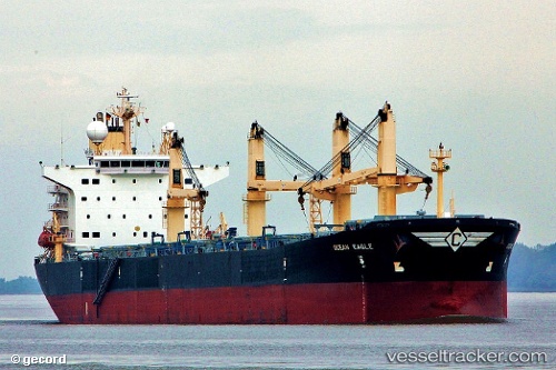
 HOANH SON SKY
Current Status
Where is the vessel?
HOANH SON SKY is currently in 53 nm N of PA-TOU-TZU, based on AIS data received less than 1h ago.
Latest AIS update:
Current position: 25.98651° N, 122.07690° E (53 nm N of PA-TOU-TZU)
Average speed (last 7 days): Loading…
Average speed (last 30 days): Loading…
Vessel profile: HOANH SON SKY is a Bulk Carrier with dimensions 225m x 225m.
This page combines live AIS, route history, probable destination signals, nearby traffic, and port activity for practical vessel monitoring.
The current position of vessel HOANH SON SKY is 25.98651 lat / 122.07690 lng. Updated: 2026-04-08 17:45:31 UTCNearest reference points:
- 11 nm N of Nangang
- Near PA-TOU-TZU
- 14 nm NE of Nangang
Currently sailing under the flag of Panama ![]()
HOANH SON SKY built in 2001 year
Deadweight:
74082 tDetails:
Live Vessel HOANH SON SKY Analytics (details, animations, etc.)
Recent AIS points (UTC):
2026-04-08 12:16:32 UTC · 25.02112, 122.29849 · SOG 9.4 kn · COG 359°2026-04-08 13:33:59 UTC · 25.23265, 122.27509 · SOG 10 kn · COG 344°
2026-04-08 15:55:10 UTC · 25.64827, 122.20130 · SOG 11.9 kn · COG 345°
2026-04-08 17:45:31 UTC · 25.98651, 122.07690 · SOG 11.5 kn · COG 332°