 vesseltracker.com
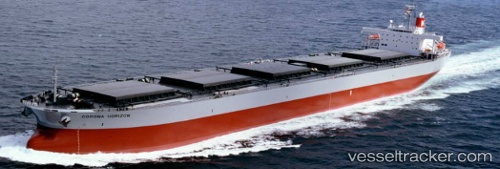
 MANALAGI DASA
Current Status
Where is the vessel?
MANALAGI DASA is currently in 67 nm W of Wamsasi, based on AIS data received about 4h ago.
Latest AIS update:
Current position: 3.84333° S, 125.08795° E (67 nm W of Wamsasi)
Average speed (last 7 days): Loading…
Average speed (last 30 days): Loading…
Vessel profile: MANALAGI DASA is a Bulk Carrier with dimensions 230m x 230m.
This page combines live AIS, route history, probable destination signals, nearby traffic, and port activity for practical vessel monitoring.
The current position of vessel MANALAGI DASA is -3.84333 lat / 125.08795 lng. Updated: 2026-03-29 19:52:04 UTCNearest reference points:
- 69 nm NW of Wainibe
- Near Labuan
- Near BAUBAU
Currently sailing under the flag of Indonesia ![]()
MANALAGI DASA built in 2000 year
Deadweight:
88315 tDetails:
Live Vessel MANALAGI DASA Analytics (details, animations, etc.)
Recent AIS points (UTC):
2026-03-29 12:02:41 UTC · -4.70990, 124.05128 · SOG 10.1 kn · COG 53°2026-03-29 17:53:51 UTC · -4.05805, 124.83312 · SOG 10.6 kn · COG 56°
2026-03-29 19:52:04 UTC · -3.84333, 125.08795 · SOG 9.9 kn · COG 56°
2026-03-29 19:52:04 UTC · -3.84333, 125.08795 · SOG 9.9 kn · COG 56°