 vesseltracker.com
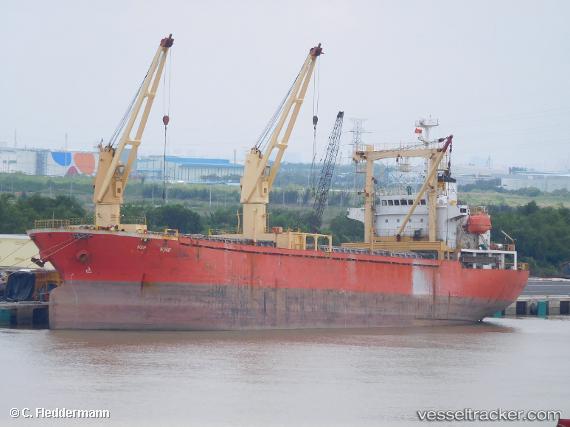
 GREENWAY
Current Status
Where is the vessel?
GREENWAY is currently in Near Massawa, based on AIS data received about 1h ago.
Latest AIS update:
Current position: 15.61330° N, 39.47805° E (Near Massawa)
Average speed (last 7 days): Loading…
Average speed (last 30 days): Loading…
Vessel profile: GREENWAY is a General Cargo with dimensions m x m.
This page combines live AIS, route history, probable destination signals, nearby traffic, and port activity for practical vessel monitoring.
The current position of vessel GREENWAY is 15.61330 lat / 39.47805 lng. Updated: 2026-03-31 13:07:46 UTCNearest reference points:
- 92 nm SW of Al Qahmah
- 81 nm NW of As Salif
Currently sailing under the flag of Saint Kitts and Nevis ![]()
Details:
Live Vessel GREENWAY Analytics (details, animations, etc.)
Recent AIS points (UTC):
2026-03-31 06:33:34 UTC · 15.61324, 39.47807 · SOG 0 kn · COG 228°2026-03-31 09:16:16 UTC · 15.61324, 39.47810 · SOG 0 kn · COG 228°
2026-03-31 11:19:25 UTC · 15.61328, 39.47812 · SOG 0 kn · COG 228°
2026-03-31 13:07:46 UTC · 15.61330, 39.47805 · SOG 0 kn · COG 229°