 vesseltracker.com
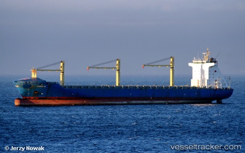
 LODUR
LODUR
Current Status
Where is the vessel?
LODUR is currently in Near Setubal, based on AIS data received about 1h ago.
Latest AIS update:
Current position: 38.50103° N, 9.12827° E (Near Setubal)
Average speed (last 7 days): Loading…
Average speed (last 30 days): Loading…
Vessel profile: LODUR is a Container Ship with dimensions m x m.
This page combines live AIS, route history, probable destination signals, nearby traffic, and port activity for practical vessel monitoring.
The current position of vessel LODUR is 38.50103 lat / 9.12827 lng. Updated: 2026-03-29 13:23:03 UTCNearest reference points:
- 33 nm SE of Setubal
- 35 nm S of Setubal
- Near SARROCH
Currently sailing under the flag of Portugal ![]()
Details:
Live Vessel LODUR Analytics (details, animations, etc.)
Recent AIS points (UTC):
2026-03-29 07:51:55 UTC · 38.69333, 7.35667 · SOG 14 kn · COG -1°2026-03-29 10:01:03 UTC · 38.64300, 8.04575 · SOG 15.8 kn · COG 91°
2026-03-29 11:45:38 UTC · 38.60444, 8.61551 · SOG 15.2 kn · COG 95°
2026-03-29 13:23:03 UTC · 38.50103, 9.12827 · SOG 15.4 kn · COG 108°