 vesseltracker.com
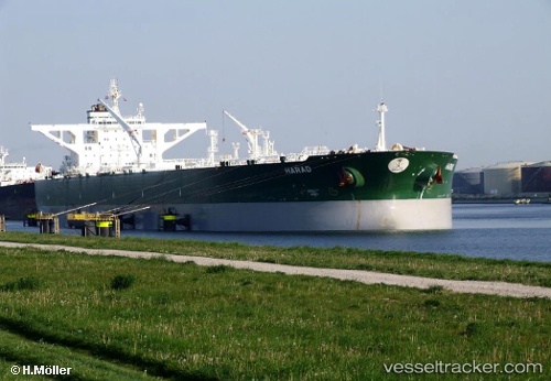
Harad
Current StatusWhere is the vessel?
Harad is currently in 18 nm SE of DUBA, based on AIS data received about 1h ago.
Latest AIS update:
Current position: 27.32116° N, 35.73810° E (18 nm SE of DUBA)
Average speed (last 7 days): Loading…
Average speed (last 30 days): Loading…
Vessel profile: Harad is a Crude Oil Tanker with dimensions 58m x 333m.
This page combines live AIS, route history, probable destination signals, nearby traffic, and port activity for practical vessel monitoring.
The current position of vessel Harad is 27.32116 lat / 35.73810 lng. Updated: 2026-04-12 06:25:21 UTCNearest reference points:
- Near DUBA
- Near Al Khuraibah
- 15 nm SW of Al Khuraibah
Details:
Live Vessel Harad Analytics (details, animations, etc.)
Recent AIS points (UTC):
2026-04-10 03:56:40 UTC · 27.32093, 35.73820 · SOG 0 kn · COG 255°2026-04-10 04:47:39 UTC · 27.32092, 35.73821 · SOG 0 kn · COG 255°
2026-04-10 06:05:38 UTC · 27.32096, 35.73822 · SOG 0 kn · COG 254°
2026-04-12 06:25:21 UTC · 27.32116, 35.73810 · SOG 0 kn · COG 261°