 vesseltracker.com
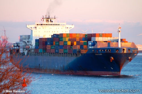
 MSC KERRY VII
Current Status
Where is the vessel?
MSC KERRY VII is currently in 12 nm N of Bonga, based on AIS data received about 1h ago.
Latest AIS update:
Current position: 4.70219° N, 4.76503° E (12 nm N of Bonga)
Average speed (last 7 days): Loading…
Average speed (last 30 days): Loading…
Vessel profile: MSC KERRY VII is a Container Ship with dimensions m x m.
This page combines live AIS, route history, probable destination signals, nearby traffic, and port activity for practical vessel monitoring.
The current position of vessel MSC KERRY VII is 4.70219 lat / 4.76503 lng. Updated: 2026-03-30 05:23:42 UTCNearest reference points:
- Near Escravos
- Near WARRI
- Near Apapa
Currently sailing under the flag of Liberia ![]()
Details:
Live Vessel MSC KERRY VII Analytics (details, animations, etc.)
Recent AIS points (UTC):
2026-03-29 23:51:54 UTC · 5.86592, 3.79546 · SOG 15.2 kn · COG 146°2026-03-30 01:44:36 UTC · 5.48353, 4.11435 · SOG 16.5 kn · COG 139°
2026-03-30 03:42:01 UTC · 5.06172, 4.46007 · SOG 17.1 kn · COG 143°
2026-03-30 05:23:42 UTC · 4.70219, 4.76503 · SOG 16.3 kn · COG 139°