 vesseltracker.com
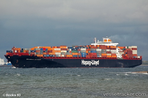
 YANTIAN EXPRESS
Current Status
Where is the vessel?
YANTIAN EXPRESS is currently in 95 nm SW of CLARK'S HARBOUR, based on AIS data received less than 1h ago.
Latest AIS update:
Current position: 42.22196° N, 67.01300° W (95 nm SW of CLARK'S HARBOUR)
Average speed (last 7 days): Loading…
Average speed (last 30 days): Loading…
Vessel profile: YANTIAN EXPRESS is a Container Ship with dimensions m x m.
This page combines live AIS, route history, probable destination signals, nearby traffic, and port activity for practical vessel monitoring.
The current position of vessel YANTIAN EXPRESS is 42.22196 lat / -67.01300 lng. Updated: 2026-04-01 17:27:27 UTCNearest reference points:
- Near Wedgeport
- Near Lower Woods Harbour
- 16 nm W of Tiverton
Currently sailing under the flag of Liberia ![]()
Details:
Live Vessel YANTIAN EXPRESS Analytics (details, animations, etc.)
Recent AIS points (UTC):
2026-04-01 11:27:53 UTC · 43.56500, -66.93667 · SOG 17 kn · COG -1°2026-04-01 13:57:54 UTC · 43.23448, -66.99686 · SOG 12.4 kn · COG 181°
2026-04-01 15:46:35 UTC · 42.72167, -67.01333 · SOG 18 kn · COG -1°
2026-04-01 17:27:27 UTC · 42.22196, -67.01300 · SOG 17.8 kn · COG 181°