 vesseltracker.com
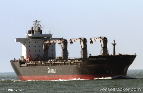
Cedar Arrow
Current StatusWhere is the vessel?
Cedar Arrow is currently in Near ITAPOA, based on AIS data received less than 1h ago.
Latest AIS update:
Current position: 26.18192° S, 48.42570° W (Near ITAPOA)
Average speed (last 7 days): Loading…
Average speed (last 30 days): Loading…
Vessel profile: Cedar Arrow is a Multi Purpose Carrier with dimensions 31m x 190m.
This page combines live AIS, route history, probable destination signals, nearby traffic, and port activity for practical vessel monitoring.
The current position of vessel Cedar Arrow is -26.18192 lat / -48.42570 lng. Updated: 2026-04-03 00:04:19 UTCNearest reference points:
- 24 nm E of Caioba
- 32 nm E of Caioba
- 10 nm NE of CAMBORIU
Details:
Live Vessel Cedar Arrow Analytics (details, animations, etc.)
Recent AIS points (UTC):
2026-04-02 17:59:43 UTC · -26.18159, -48.42637 · SOG 0.5 kn · COG 49°2026-04-02 19:50:06 UTC · -26.18236, -48.42493 · SOG 0.6 kn · COG -1°
2026-04-02 21:37:34 UTC · -26.18242, -48.42507 · SOG 2 kn · COG 6°
2026-04-03 00:04:19 UTC · -26.18192, -48.42570 · SOG 0.5 kn · COG 47°