 vesseltracker.com
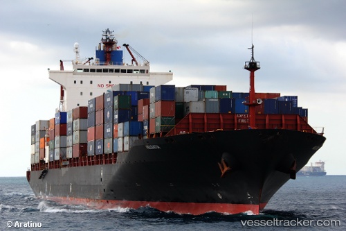
 HOLSATIA
Current Status
Where is the vessel?
HOLSATIA is currently in 36 nm NE of PENGERANG, based on AIS data received less than 1h ago.
Latest AIS update:
Current position: 1.55676° N, 104.72024° E (36 nm NE of PENGERANG)
Average speed (last 7 days): Loading…
Average speed (last 30 days): Loading…
Vessel profile: HOLSATIA is a Container Ship with dimensions 32m x 260m.
This page combines live AIS, route history, probable destination signals, nearby traffic, and port activity for practical vessel monitoring.
The current position of vessel HOLSATIA is 1.55676 lat / 104.72024 lng. Updated: 2026-03-29 12:25:02 UTCNearest reference points:
- 38 nm E of PENGERANG
- 34 nm NE of PENGERANG
- 47 nm NE of PENGERANG
Currently sailing under the flag of Liberia ![]()
HOLSATIA built in 2003 year
Deadweight:
50790 tDetails:
Live Vessel HOLSATIA Analytics (details, animations, etc.)
Recent AIS points (UTC):
2026-03-29 05:45:43 UTC · 1.57713, 104.76225 · SOG 0.4 kn · COG 319°2026-03-29 07:42:12 UTC · 1.57468, 104.77191 · SOG 0.6 kn · COG 307°
2026-03-29 09:41:12 UTC · 1.59058, 104.72659 · SOG 0.8 kn · COG 336°
2026-03-29 12:25:02 UTC · 1.55676, 104.72024 · SOG 1.5 kn · COG 332°