 vesseltracker.com
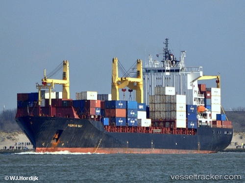
 SM MAHI
Current Status
Where is the vessel?
SM MAHI is currently in 31 nm SW of Okha, based on AIS data received about 1h ago.
Latest AIS update:
Current position: 22.25912° N, 68.58761° E (31 nm SW of Okha)
Average speed (last 7 days): Loading…
Average speed (last 30 days): Loading…
Vessel profile: SM MAHI is a Container Ship with dimensions 208m x 32m.
This page combines live AIS, route history, probable destination signals, nearby traffic, and port activity for practical vessel monitoring.
The current position of vessel SM MAHI is 22.25912 lat / 68.58761 lng. Updated: 2026-04-02 05:26:28 UTCNearest reference points:
- 49 nm S of Positra
- 13 nm W of Måndvi
- 54 nm S of Positra
Currently sailing under the flag of India ![]()
SM MAHI built in 2002 year
Deadweight:
35766 tDetails:
Live Vessel SM MAHI Analytics (details, animations, etc.)
Recent AIS points (UTC):
2026-04-01 23:22:44 UTC · 21.93294, 67.68078 · SOG 11.5 kn · COG 69°2026-04-02 01:59:09 UTC · 22.11594, 68.20183 · SOG 11.9 kn · COG 73°
2026-04-02 04:10:22 UTC · 22.25334, 68.58712 · SOG 3 kn · COG -1°
2026-04-02 05:26:28 UTC · 22.25912, 68.58761 · SOG 1 kn · COG -1°