 vesseltracker.com
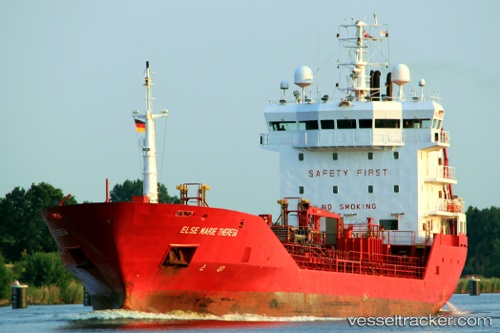
 ENKI
ENKI
Current Status
Where is the vessel?
ENKI is currently in 20 nm E of Port Sultan, based on AIS data received about 1h ago.
Latest AIS update:
Current position: 23.70455° N, 58.98954° E (20 nm E of Port Sultan)
Average speed (last 7 days): Loading…
Average speed (last 30 days): Loading…
Vessel profile: ENKI is a Chemical/Oil Products Tanker with dimensions 96m x 14m.
This page combines live AIS, route history, probable destination signals, nearby traffic, and port activity for practical vessel monitoring.
The current position of vessel ENKI is 23.70455 lat / 58.98954 lng. Updated: 2026-04-15 11:56:09 UTCNearest reference points:
- 23 nm NE of Qalhat
- 58 nm S of JASK
- 59 nm S of Chah Bahar
Currently sailing under the flag of St.Kitts and Nevis ![]()
ENKI built in 2001 year
Deadweight:
4307 tDetails:
Live Vessel ENKI Analytics (details, animations, etc.)
Recent AIS points (UTC):
2026-04-15 05:42:44 UTC · 24.19027, 58.31200 · SOG 7.7 kn · COG -1°2026-04-15 07:36:08 UTC · 24.04203, 58.51483 · SOG 7.4 kn · COG -1°
2026-04-15 10:11:06 UTC · 23.84261, 58.79576 · SOG 7.6 kn · COG -1°
2026-04-15 11:56:09 UTC · 23.70455, 58.98954 · SOG 7.8 kn · COG -1°