 vesseltracker.com
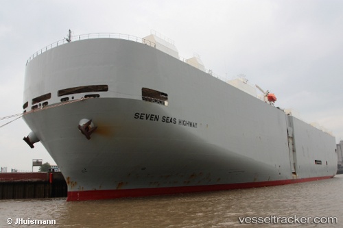
 Seven Seas Highway
Current Status
Where is the vessel?
Seven Seas Highway is currently in Near Tardinghen, based on AIS data received about 1h ago.
Latest AIS update:
Current position: 50.91502° N, 1.50496° E (Near Tardinghen)
Average speed (last 7 days): Loading…
Average speed (last 30 days): Loading…
Vessel profile: Seven Seas Highway is a Vehicles Carrier with dimensions 200m x 200m.
This page combines live AIS, route history, probable destination signals, nearby traffic, and port activity for practical vessel monitoring.
The current position of vessel Seven Seas Highway is 50.91502 lat / 1.50496 lng. Updated: 2026-03-26 22:17:58 UTCNearest reference points:
- Near Dover
- Near Sangatte
- Near Le Portel
Currently sailing under the flag of Panama ![]()
Seven Seas Highway built in 2001 year
Deadweight:
17232 tDetails:
Live Vessel Seven Seas Highway Analytics (details, animations, etc.)
Recent AIS points (UTC):
2026-03-26 15:46:17 UTC · 50.40664, 0.47524 · SOG 9.1 kn · COG 75°2026-03-26 17:31:37 UTC · 50.47562, 0.87090 · SOG 9 kn · COG 74°
2026-03-26 19:24:27 UTC · 50.60846, 1.21020 · SOG 7 kn · COG 55°
2026-03-26 22:17:58 UTC · 50.91502, 1.50496 · SOG 8.4 kn · COG 40°