 vesseltracker.com
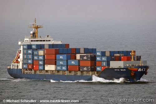
 HARBOUR ICONIC
Current Status
Where is the vessel?
HARBOUR ICONIC is currently in Near Muara, based on AIS data received about 1d ago.
Latest AIS update:
Current position: 5.08118° N, 115.10015° E (Near Muara)
Average speed (last 7 days): Loading…
Average speed (last 30 days): Loading…
Vessel profile: HARBOUR ICONIC is a Container Ship with dimensions m x m.
This page combines live AIS, route history, probable destination signals, nearby traffic, and port activity for practical vessel monitoring.
The current position of vessel HARBOUR ICONIC is 5.08118 lat / 115.10015 lng. Updated: 2026-04-10 07:31:39 UTCNearest reference points:
- Near Kikeh
- 11 nm N of MIRI
- 44 nm SW of Tembungo
Currently sailing under the flag of Malaysia ![]()
Details:
Live Vessel HARBOUR ICONIC Analytics (details, animations, etc.)
Recent AIS points (UTC):
2026-04-10 01:37:38 UTC · 5.08237, 115.10003 · SOG 0 kn · COG 250°2026-04-10 04:13:39 UTC · 5.08160, 115.10010 · SOG 0 kn · COG 287°
2026-04-10 05:43:39 UTC · 5.08153, 115.10013 · SOG 0 kn · COG 291°
2026-04-10 07:31:39 UTC · 5.08118, 115.10015 · SOG 0 kn · COG 302°