 vesseltracker.com
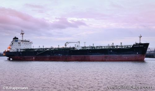
 Mt.emmanuel
Current Status
Where is the vessel?
Mt.emmanuel is currently in Near Balikpapan, based on AIS data received about 1h ago.
Latest AIS update:
Current position: 1.26182° S, 116.81218° E (Near Balikpapan)
Average speed (last 7 days): Loading…
Average speed (last 30 days): Loading…
Vessel profile: Mt.emmanuel is a Chemical Oil Products Tanker with dimensions 182m x 28m.
This page combines live AIS, route history, probable destination signals, nearby traffic, and port activity for practical vessel monitoring.
The current position of vessel Mt.emmanuel is -1.26182 lat / 116.81218 lng. Updated: 2026-03-30 04:01:10 UTCNearest reference points:
- Near Balikpapan
- Near KARIANGAU
- Near Penajam
Currently sailing under the flag of Indonesia ![]()
Mt.emmanuel built in 2002 year
Deadweight:
37113 tDetails:
Live Vessel Mt.emmanuel Analytics (details, animations, etc.)
Recent AIS points (UTC):
2026-03-29 21:55:10 UTC · -1.26188, 116.81222 · SOG 0 kn · COG -1°2026-03-30 00:04:11 UTC · -1.26192, 116.81215 · SOG 0 kn · COG -1°
2026-03-30 01:31:10 UTC · -1.26188, 116.81217 · SOG 0 kn · COG -1°
2026-03-30 04:01:10 UTC · -1.26182, 116.81218 · SOG 0 kn · COG -1°