 vesseltracker.com
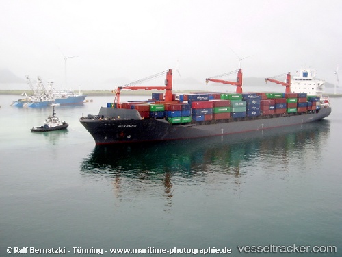
 NYRA2
NYRA2
Current Status
Where is the vessel?
NYRA2 is currently in 15 nm SW of Galle, based on AIS data received about 1h ago.
Latest AIS update:
Current position: 5.85984° N, 80.04743° E (15 nm SW of Galle)
Average speed (last 7 days): Loading…
Average speed (last 30 days): Loading…
Vessel profile: NYRA2 is a Container Ship with dimensions m x m.
This page combines live AIS, route history, probable destination signals, nearby traffic, and port activity for practical vessel monitoring.
The current position of vessel NYRA2 is 5.85984 lat / 80.04743 lng. Updated: 2026-04-01 20:15:34 UTCNearest reference points:
- 19 nm SW of Bataduwa
- 15 nm S of Koggala
- 38 nm SW of Galle
Currently sailing under the flag of Comoros ![]()
Details:
Live Vessel NYRA2 Analytics (details, animations, etc.)
Recent AIS points (UTC):
2026-04-01 13:43:31 UTC · 5.85506, 81.79285 · SOG 15.7 kn · COG 270°2026-04-01 15:36:55 UTC · 5.85638, 81.28663 · SOG 16.4 kn · COG 273°
2026-04-01 17:41:24 UTC · 5.83725, 80.73231 · SOG 16.1 kn · COG 264°
2026-04-01 20:15:34 UTC · 5.85984, 80.04743 · SOG 15.9 kn · COG 294°