 vesseltracker.com
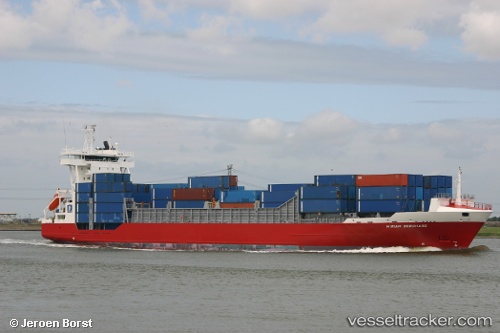
 HARBOUR GALAXY
Current Status
Where is the vessel?
HARBOUR GALAXY is currently in 10 nm NE of Senari - Sarawak, based on AIS data received about 7h ago.
Latest AIS update:
Current position: 1.72869° N, 110.54145° E (10 nm NE of Senari - Sarawak)
Average speed (last 7 days): Loading…
Average speed (last 30 days): Loading…
Vessel profile: HARBOUR GALAXY is a Container Ship with dimensions 133m x 19m.
This page combines live AIS, route history, probable destination signals, nearby traffic, and port activity for practical vessel monitoring.
The current position of vessel HARBOUR GALAXY is 1.72869 lat / 110.54145 lng. Updated: 2026-03-27 05:23:42 UTCNearest reference points:
- 17 nm SW of Sanggau
- 12 nm SE of PONTIANAK
- 28 nm SW of BINTULU
Currently sailing under the flag of Malaysia ![]()
HARBOUR GALAXY built in 2002 year
Deadweight:
7977 tDetails:
Live Vessel HARBOUR GALAXY Analytics (details, animations, etc.)
Recent AIS points (UTC):
2026-03-26 17:33:29 UTC · 3.70130, 112.45186 · SOG 15.5 kn · COG -1°2026-03-26 17:33:29 UTC · 3.70130, 112.45186 · SOG 15.5 kn · COG -1°
2026-03-27 05:23:42 UTC · 1.72869, 110.54145 · SOG 3.7 kn · COG 181°
2026-03-27 05:23:42 UTC · 1.72869, 110.54145 · SOG 3.7 kn · COG 181°