 vesseltracker.com
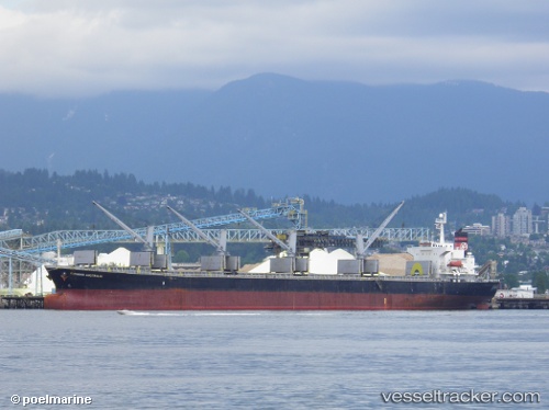
 ETANIA
Current Status
Where is the vessel?
ETANIA is currently in Near Dalzavod, based on AIS data received about 1h ago.
Latest AIS update:
Current position: 43.04981° N, 131.92529° E (Near Dalzavod)
Average speed (last 7 days): Loading…
Average speed (last 30 days): Loading…
Vessel profile: ETANIA is a Bulk Carrier with dimensions m x m.
This page combines live AIS, route history, probable destination signals, nearby traffic, and port activity for practical vessel monitoring.
The current position of vessel ETANIA is 43.04981 lat / 131.92529 lng. Updated: 2026-03-31 13:23:48 UTCNearest reference points:
- Near Dalzavod
- Near Vostokmorservice
- Near Vladivostok
Currently sailing under the flag of Panama ![]()
Details:
Live Vessel ETANIA Analytics (details, animations, etc.)
Recent AIS points (UTC):
2026-03-31 08:07:59 UTC · 43.10246, 131.88518 · SOG 0 kn · COG 51°2026-03-31 10:11:34 UTC · 43.06259, 131.90643 · SOG 4 kn · COG 120°
2026-03-31 11:29:45 UTC · 43.05134, 131.92531 · SOG 0.1 kn · COG 226°
2026-03-31 13:23:48 UTC · 43.04981, 131.92529 · SOG 0.1 kn · COG 285°