 vesseltracker.com
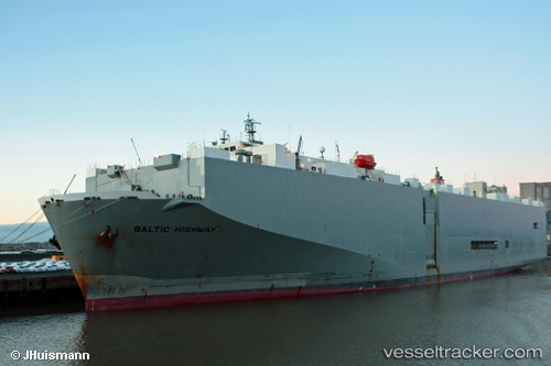
Baltic Highway
Current StatusWhere is the vessel?
Baltic Highway is currently in 17 nm NW of San Juan Bautista, based on AIS data received about 7h ago.
Latest AIS update:
Current position: 39.31708° N, 1.27709° E (17 nm NW of San Juan Bautista)
Average speed (last 7 days): Loading…
Average speed (last 30 days): Loading…
Vessel profile: Baltic Highway is a Vehicles Carrier with dimensions 31m x 180m.
This page combines live AIS, route history, probable destination signals, nearby traffic, and port activity for practical vessel monitoring.
The current position of vessel Baltic Highway is 39.31708 lat / 1.27709 lng. Updated: 2026-04-01 09:11:26 UTCNearest reference points:
- 18 nm NW of Sant Antoni de Portmany
- Near Sant Antoni de Portmany
- Near SANT ANTONI
Details:
Live Vessel Baltic Highway Analytics (details, animations, etc.)
Recent AIS points (UTC):
2026-04-01 07:55:03 UTC · 39.33253, 1.15000 · SOG 4.4 kn · COG 82°2026-04-01 09:11:26 UTC · 39.31708, 1.27709 · SOG 4.8 kn · COG 80°
2026-04-01 09:11:26 UTC · 39.31708, 1.27709 · SOG 4.8 kn · COG 80°
2026-04-01 09:11:26 UTC · 39.31708, 1.27709 · SOG 4.8 kn · COG 80°