 vesseltracker.com
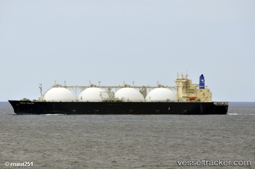
 ARUNIKA JAYA
Current Status
Where is the vessel?
ARUNIKA JAYA is currently in 49 nm NW of Basco, based on AIS data received about 1d ago.
Latest AIS update:
Current position: 20.86798° N, 121.21475° E (49 nm NW of Basco)
Average speed (last 7 days): Loading…
Average speed (last 30 days): Loading…
Vessel profile: ARUNIKA JAYA is a Lng Tanker with dimensions m x m.
This page combines live AIS, route history, probable destination signals, nearby traffic, and port activity for practical vessel monitoring.
The current position of vessel ARUNIKA JAYA is 20.86798 lat / 121.21475 lng. Updated: 2026-04-10 08:24:40 UTCNearest reference points:
- 66 nm W of Basco
- 106 nm W of Basco
- 101 nm S of Kaohsiung
Currently sailing under the flag of Indonesia ![]()
Details:
Live Vessel ARUNIKA JAYA Analytics (details, animations, etc.)
Recent AIS points (UTC):
2026-04-10 01:47:58 UTC · 19.66555, 120.57954 · SOG 11.6 kn · COG -1°2026-04-10 03:50:50 UTC · 20.01619, 120.74957 · SOG 11.5 kn · COG 23°
2026-04-10 05:36:10 UTC · 20.33502, 120.90526 · SOG 12.3 kn · COG 19°
2026-04-10 08:24:40 UTC · 20.86798, 121.21475 · SOG 12.7 kn · COG 49°