 vesseltracker.com
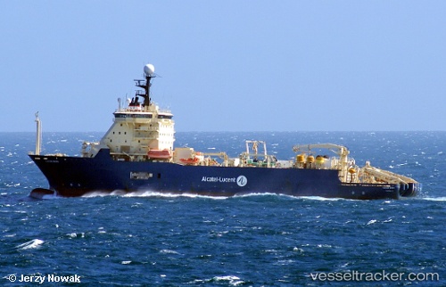
Ile De Sein
Current StatusWhere is the vessel?
Ile De Sein is currently in 77 nm E of San Andrés, based on AIS data received less than 1h ago.
Latest AIS update:
Current position: 12.29193° N, 80.42845° W (77 nm E of San Andrés)
Average speed (last 7 days): Loading…
Average speed (last 30 days): Loading…
Vessel profile: Ile De Sein is a Cable Layer with dimensions 24m x 140m.
This page combines live AIS, route history, probable destination signals, nearby traffic, and port activity for practical vessel monitoring.
The current position of vessel Ile De Sein is 12.29193 lat / -80.42845 lng. Updated: 2026-04-19 23:59:57 UTCDetails:
Live Vessel Ile De Sein Analytics (details, animations, etc.)
Recent AIS points (UTC):
2026-04-19 20:00:52 UTC · 11.50760, -80.29899 · SOG 11.4 kn · COG 352°2026-04-19 20:41:07 UTC · 11.63500, -80.32178 · SOG 11.6 kn · COG 354°
2026-04-19 22:34:50 UTC · 12.01502, -80.38172 · SOG 12.3 kn · COG -1°
2026-04-19 23:59:57 UTC · 12.29193, -80.42845 · SOG 12.1 kn · COG -1°