 vesseltracker.com
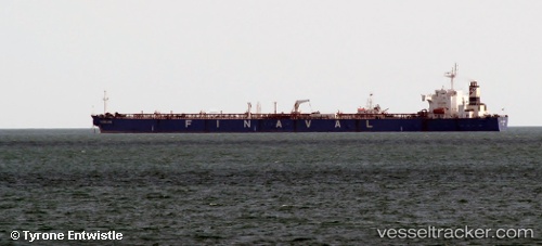
 TORNADO A
Current Status
Where is the vessel?
TORNADO A is currently in 11 nm SE of Bnei Darom, based on AIS data received about 7h ago.
Latest AIS update:
Current position: 31.74238° N, 31.87286° E (11 nm SE of Bnei Darom)
Average speed (last 7 days): Loading…
Average speed (last 30 days): Loading…
Vessel profile: TORNADO A is a Crude Oil Tanker with dimensions m x m.
This page combines live AIS, route history, probable destination signals, nearby traffic, and port activity for practical vessel monitoring.
The current position of vessel TORNADO A is 31.74238 lat / 31.87286 lng. Updated: 2026-04-01 08:33:12 UTCNearest reference points:
- Near Damietta
- 21 nm N of Port Said
- 15 nm N of Port Said
Currently sailing under the flag of Panama ![]()
Details:
Live Vessel TORNADO A Analytics (details, animations, etc.)
Recent AIS points (UTC):
2026-04-01 08:00:19 UTC · 31.74235, 31.87289 · SOG 0.7 kn · COG -1°2026-04-01 08:33:12 UTC · 31.74238, 31.87286 · SOG 0.8 kn · COG -1°
2026-04-01 08:33:12 UTC · 31.74238, 31.87286 · SOG 0.8 kn · COG -1°
2026-04-01 08:33:12 UTC · 31.74238, 31.87286 · SOG 0.8 kn · COG -1°