 vesseltracker.com
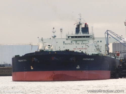
 MAISTROS
Current Status
Where is the vessel?
MAISTROS is currently in 259 nm W of Tinaquillo, based on AIS data received about 2h ago.
Latest AIS update:
Current position: 11.14413° N, 64.08910° E (259 nm W of Tinaquillo)
Average speed (last 7 days): Loading…
Average speed (last 30 days): Loading…
Vessel profile: MAISTROS is a Crude Oil Tanker with dimensions m x m.
This page combines live AIS, route history, probable destination signals, nearby traffic, and port activity for practical vessel monitoring.
The current position of vessel MAISTROS is 11.14413 lat / 64.08910 lng. Updated: 2026-03-31 10:44:46 UTCNearest reference points:
- Open sea, approx. 402 nm off the nearest listed port
- Open sea, approx. 403 nm off the nearest listed port
- Open sea, approx. 405 nm off the nearest listed port
Currently sailing under the flag of Panama ![]()
Details:
Live Vessel MAISTROS Analytics (details, animations, etc.)
Recent AIS points (UTC):
2026-03-31 06:11:03 UTC · 11.46987, 63.20668 · SOG 12.3 kn · COG 110°2026-03-31 07:08:29 UTC · 11.40102, 63.39390 · SOG 12.1 kn · COG 109°
2026-03-31 08:28:46 UTC · 11.30500, 63.64947 · SOG 12.1 kn · COG 109°
2026-03-31 10:44:46 UTC · 11.14413, 64.08910 · SOG 12.2 kn · COG 111°