 vesseltracker.com
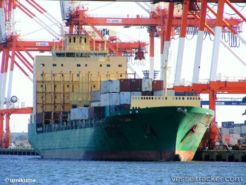
 MEDKON ANKARA
Current Status
Where is the vessel?
MEDKON ANKARA is currently in 11 nm SW of Néa Kallikrátia, based on AIS data received about 1h ago.
Latest AIS update:
Current position: 40.23227° N, 22.85557° E (11 nm SW of Néa Kallikrátia)
Average speed (last 7 days): Loading…
Average speed (last 30 days): Loading…
Vessel profile: MEDKON ANKARA is a Container Ship with dimensions m x m.
This page combines live AIS, route history, probable destination signals, nearby traffic, and port activity for practical vessel monitoring.
The current position of vessel MEDKON ANKARA is 40.23227 lat / 22.85557 lng. Updated: 2026-03-28 21:46:23 UTCNearest reference points:
- Near Agriá
- Near Volos
- Near Ammoulianí
Currently sailing under the flag of Turkey ![]()
Details:
Live Vessel MEDKON ANKARA Analytics (details, animations, etc.)
Recent AIS points (UTC):
2026-03-28 15:39:03 UTC · 39.58818, 23.28472 · SOG 7.9 kn · COG 327°2026-03-28 18:10:04 UTC · 39.87810, 23.09710 · SOG 7.8 kn · COG 330°
2026-03-28 19:39:54 UTC · 40.04542, 22.97961 · SOG 6.8 kn · COG 333°
2026-03-28 21:46:23 UTC · 40.23227, 22.85557 · SOG 5.9 kn · COG 337°